
Niagara Falls Ontario, a great representation of the marvel in the landscape of the Niagara Region
Landform Region -Great Lakes St. Lawrence Lowlands-
|
=
To the north of St. Catharines is the smallest of the great lakes, lake Ontario. St. Catharines also serves as the end of the Welland Canal spanning from Port Colbourne to St. Catharines, this makes St Catharines important for Canada's international trade. Annually over 40, 000, 000 tonnes of cargo travels through the Canal. This makes St. Catharines a relatively important port city. What makes St Catharines' location so ideal for building a city is the fact that it is so close to lake Ontario making fresh water readily available, the climate is relatively mild. The surrounding area proves that the soil is very fertile and ideal for growing certain crops. In addition there are also various different fresh water fish located in the lake making for a sustainable food source (if harvested smartly). Overall there are little to no setbacks as to why St. Catharines is a bad location for a city, in fact it is a very good location. |
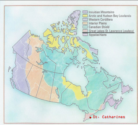
St. Catharines relative to other landform regions
|
Ecozone -Mixed Wood Plains-
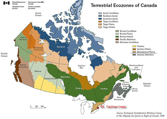
St Catharines relative to other Ecozones
|
The Mixed Wood Plains is an ecozone filled with rich fertile soil that engulfs the surrounding areas of three great lakes and the St. Lawrence River. The climate is relatively temperate with cold winters and warm summers. The growing season is pretty standard for the area spanning from early May to early October. In terms of drastic changes in weather St. Catharines is fairly safe, the only thing that may be a problem would be flooding of the Canal and the lake but other than that it is probably unlikely anything too severe will occur.
Like most cities of the world St Catharines is and will continue to feel the consequences of climate change now and in the near to distant future. Some of the effects will be: Increase in temperature and heat waves, longer growing season, rainier winters, increase in heavy rain, and longer dry spells in the summer. However in the distant future we could see more drastic effects such as: 20% decrease in rainfall, and a significant growth of severe weather such as thunderstorms, hail storms, high winds, and tornadoes. |
St. Catharines Climate Graph
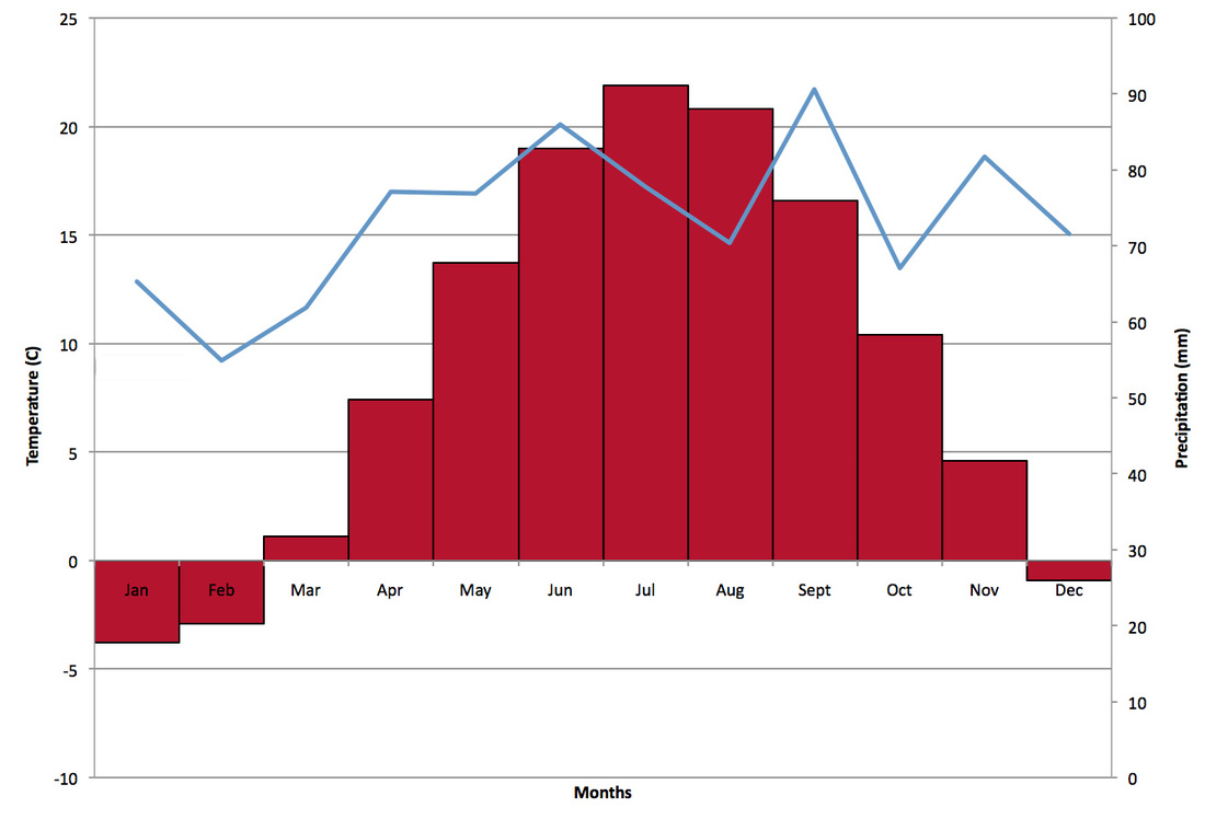
Here is The Climate Graph for St. Catharines
|
Climate is very similar to that of other cities in Southern Ontario such as Toronto. The lowest average temperature is -4 in January and 22 in July. This will see a raise in the coming years due to climate change.
|
Download the file above for a more illustrated view of St. Catharines Climate
| ||
